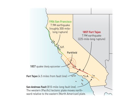
On the morning of January 9, 1857, the Fort Tejon earthquake, one of the strongest ever recorded in the U.S., struck Southern California. Its strength was such that it was reported to have caused rivers to flow backward and lake waters to be thrown upon their shores, stranding fish miles from original lake beds.
A lonely military outpost, Fort Tejon—built a few years earlier in sparsely populated, 1850s Southern California—took the brunt of the quake. “We have accounts from one of the commanding officers, Captain John W.T. Gardiner, who was there the morning it hit,” says Michael Deagon, an interpreter at Fort Tejon State Historic Park, a 75-mile drive high into mountains northwest of Los Angeles. “In letters, Captain Gardiner describes being thrown from his bed across the floor and not able to get on his feet because of the intensity of the earthquake.” Throughout southern and central California, the strong shaking caused by the 1857 shock was reported to have lasted for at least one minute, possibly upwards of three. The earthquake acquired its name because Fort Tejon was the largest population center near the fault, but the quake’s epicenter was actually 100 miles to the northwest of the fort, near Parkfield, Calif.—the self-proclaimed “earthquake capitol of the world”.
The magnitude-7.9 Fort Tejon earthquake of 1857 is more of an a historical footnote compared to the devastating 1906 San Francisco quake (and fire that followed). A repeat of the Fort Tejon temblor in the now-populous Inland Empire region east of Los Angeles could potentially kill thousands and cause of tens of billions of dollars in damage.
1
of 7
Library of Congress
Library of Congress
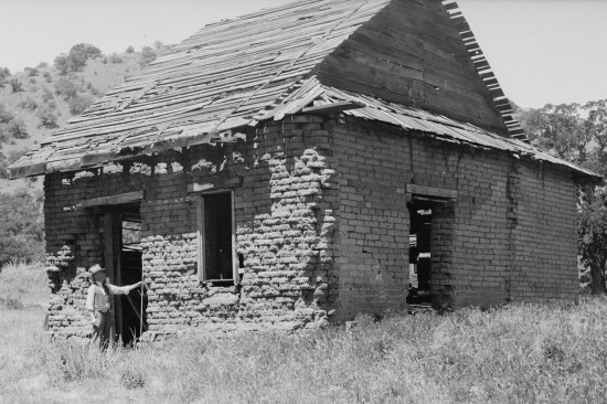
The remnants of the Officers’ Quarters as viewed from the west…
The remnants of the Officers’ Quarters as viewed from the west. The survey was conducted under the auspices of the Works Progress Administration (WPA), an ambitious employment and infrastructure program created in the mid 1930s, which put roughly 8.5 million Americans to work during the bleakest years of the Great Depression. See Withey’s WPA-era survey drawings.
Library of Congress
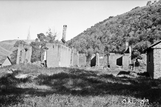
The First U.S. Dragoons (mounted infantry) arrived on August 10,…
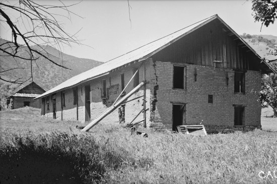
The First U.S. Dragoons (mounted infantry) arrived on August 10, 1854 and began construction on roughly 40 military buildings. The fort’s purpose was to guard the Grapevine Pass through the Tehachapi Mountains at Lebec, Kern County, Calif. The remaining south end of Barracks Building #2 and the largely intact Barracks Building #1 shown in the background, viewed from the south.
Library of Congress
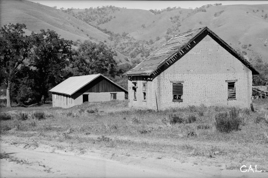
The northeast corner of Barracks #1 was braced in 1916 to keep t…
The northeast corner of Barracks #1 was braced in 1916 to keep the wall from collapsing. Restoration architect Clarence Cullimore noted in 1949, “the builders did not know that they were building the Fort almost directly over an earthquake fault, and but three miles from the now well-defined and occasionally active, San Andreas fault.”
Library of Congress
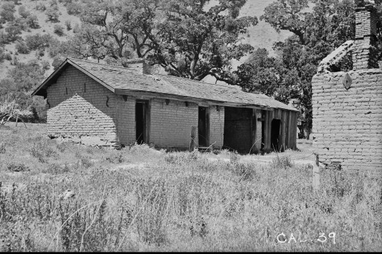
The Soldiers’ Quarters as viewed from the northeast. Cullimore…
The Soldiers’ Quarters as viewed from the northeast. Cullimore, “since its abandonment in 1864, the buildings have been used as residences, stables, or sheds, or have remained unused. A few repairs have made some of the buildings adequate as ranch structures.” And, “in several places, however, large structural cracks have occurred. These considerably weaken the structure and have evidently caused the owners of the property to introduce iron tie rods at various points to strengthen it.”
Library of Congress
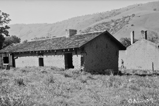
The Soldiers’ Quarters as viewed from the southeast. With the …
The Soldiers’ Quarters as viewed from the southeast. With the outbreak of the Civil War in 1861, the dragoons were sent to guard Los Angeles and later transferred east to fight in the war. It was later abandoned September 11, 1864.
Library of Congress
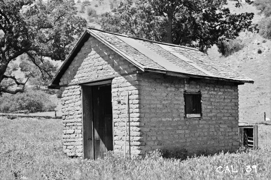
A smoke house viewed from the northeast.
1
of 8
Courtesy California State Parks
Courtesy California State Parks
Ariel view of Fort Tejon viewed from the south. At an elevation …
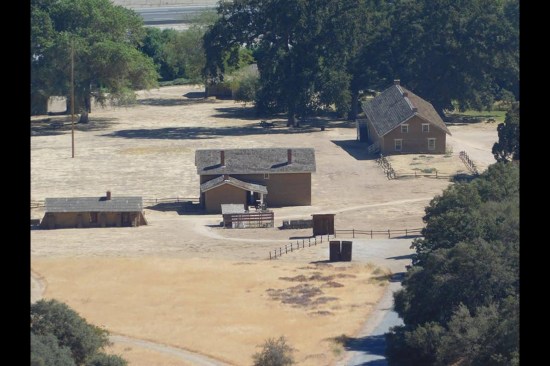
Ariel view of Fort Tejon viewed from the south. At an elevation of over 3,500 feet, Fort Tejon State Historic Park is situated in the rugged Tehachapi Mountains near Tejon Pass on Interstate 5 (I-5 is seen in the background).
Courtesy California State Parks
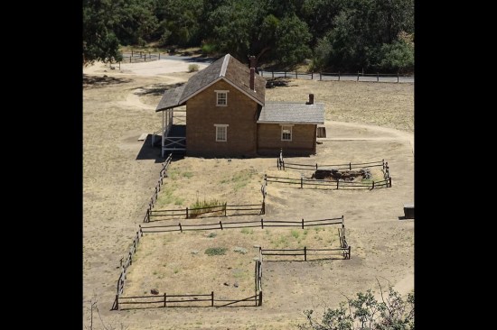
Reconstructed Officers’ Quarters as viewed from the west. Spli…
Reconstructed Officers’ Quarters as viewed from the west. Split rail fencing denotes footprint of the previously standing Officers’ Quarters adjacent to the reconstructed structure.
Courtesy California State Parks
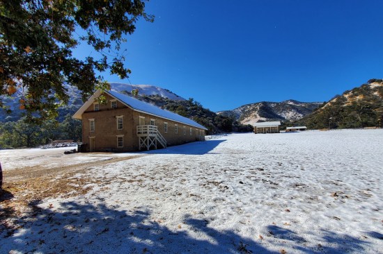
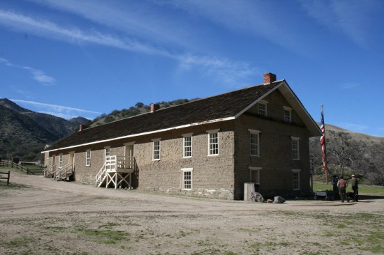
Gable-end view of re-constructed Barracks as viewed from north. …
Gable-end view of re-constructed Barracks as viewed from north. Winter temperatures can dip to freezing, with the possibility of snow. Grapevine Canyon is known for occasional strong winds.
Courtesy California State Parks
East elevation of re-constructed Barracks.
Courtesy California State Parks
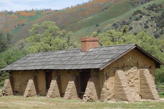
Rear elevation of the Orderlies’ Quarters (previously referred…
Rear elevation of the Orderlies’ Quarters (previously referred to as the “Soldiers’ Quarters”) as viewed from south. The structure is state of “arrested decay”—adobe buttresses were placed around an exterior wall in the 1950s to stabilize it until it could be fully preserved.
Courtesy California State Parks
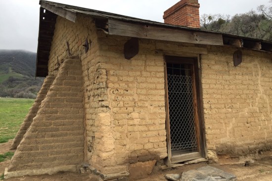
Northeast corner of the Orderlies’ Quarters, front elevation. …
Northeast corner of the Orderlies’ Quarters, front elevation. Adobe buttresses were placed in the early 1950s after the Tehachapi earthquake in 1952 to help shore up the building (large wood beams buttress the interior walls as well). To strengthen the structure, iron tie rods were introduced at some point prior to the 1937 Buildings Survey.
Courtesy California State Parks
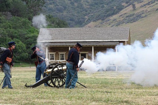
Reenactors fire off a field cannon on the fort’s parade ground…
Reenactors fire off a field cannon on the fort’s parade ground. Restoration began on the adobe buildings in 1947 and continues to this day. The original barracks building, the reconstructed officers’ quarters, and various other structures stand as reminders of Fort Tejon’s military history.
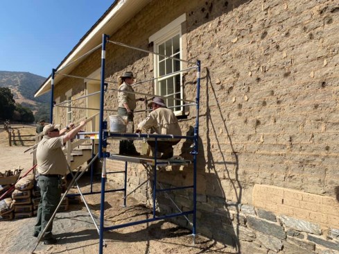
Damage, abandonment, and restoration. Restoration architect Clarence Cullimore gave a sense of the damage in Old Adobes of Forgotten Fort Tejon (1949). As reported by the Los Angeles Star on January 24, 1857, “Quarters occupied by Lt. Col. Beall has received more damage than any other finished building on the Post. Its chimnies [sic] have been thrown down, its plastering broken off in many places, and one of its ends so badly shaken and cracked as to be too insecure to be occupied.”
The fort was rebuilt, but was later abandoned in September 1864. Once deserted, its many structures fell into decay, with rain and mountain snows taking their toll on the unprotected adobe wall surfaces.
According to Deagon, “It was the late ’40s, early ’50s when they started rebuilding some of the structures. The park plan still calls for 15 other old historic structures to be rebuilt.” A third of the original structures have been restored with one in a state of “arrested decay”—adobe buttresses were placed around an exterior wall in the 1950s to stabilize it until it could be fully preserved.
The next “big one.” Deagon notes, “It was the last major earthquake of that size to hit this area. Seismologists tell us this part of the San Andreas tends to be on a 150-year cycle and the earthquake was over 160 years ago. So we’re kind of overdue.”